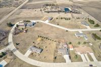
Homes For Sales on West Lake Okoboji
West Okoboji Lake
| West Okoboji Lake | |
|---|---|
.jpg) |
|
| Location | Dickinson County, Iowa |
| Coordinates | 43°23′04″N095°09′34″WCoordinates: 43°23′04″N 095°09′34″W |
| Catchment area | 125 sq mi (320 km2) |
| Basin countries | United States |
| Surface area | 3,847 acres (1,557 ha) |
| Average depth | 39 ft (12 m) |
| Max. depth | 136 ft (41 m) |
| Surface elevation | 1,398 ft (426 m) |
| Islands | 0 |
| Settlements | Arnolds Park Okoboji Wahpeton West Okoboji |

West Okoboji Lake (sometimes known as West Lake Okoboji) is a natural body of water, approximately 3,847 acres (15.57 km2) in area, in Dickinson County in northwest Iowa in the United States. It is part of the chain of lakes known as the Iowa Great Lakes. The area was long inhabited by the Santee or Dakota Sioux. The Dakota-language name for the lake was Minnetonka, meaning "great waters".
The cities of Arnolds Park, Okoboji, West Okoboji, and Wahpeton sit on its shore. Okoboji was derived from the Dakota name for the lake, and Wahpeton was the name of one of the major historic Sioux bands in the nineteenth century. Today the Sisseton-Wahpeton Sioux are a federally recognized tribe.
The lake's maximum depth is 136 feet (41 m), making it the deepest lake in Iowa and second in size only to Spirit Lake. The mean depth is 39 feet (12 m). The drainage area of the lake is approximately 125 square miles (320 km2).[1]
Recreation
The depth of the lake makes it a popular regional destination for motor boating, water skiing, sailing, and swimming. The lake is also a popular fishing destination in the region. The main catches in the lake are yellow perch, bluegill, and walleye. It also contains significant populations of smallmouth bass, northern pike, muskie, crappie and white bass, black bass.